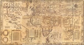
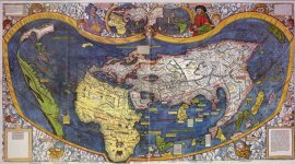
Continent of North America does not exist... or could it be a part of Asia?

LOL, just kidding, of course it exists. But than again, I was only told that it does. I flew a lot of airplane miles. I drove thousands of road miles. I have not seen anything to confirm the below hypothesis. At the same time, I have seen actual places, but I did not see the entire planet from above. Nothing in my experience, or educational background supports this hypothesis. We have GPSs guiding our travels. We have Google Earth capable of showing us even the most distant areas with great detail. Yet, there are a few intricate historical details which prompted me to share some of the observations I made looking through various maps, and documents. Maps, in particular, do raise a few questions, for certain things do raise questions. Primarily why would questionable things of this nature exist in first place?

I will start by mentioning a person named Hubert Howe Bancroft. According to Wikipedia, "Hubert Howe Bancroft (1832 – 1918) was an American historian and ethnologist who wrote, published and collected works concerning the western United States, Texas, California, Alaska, Mexico, Central America and British Columbia."

Hubert Howe Bancroft
Hubert_Howe_Bancroft.jpg

1832 – 1918
Source: The Works of Hubert Howe Bancroft - This is a 39-volume collection of histories of western North America and Central America, written by Hubert Howe Bancroft. It was published in San Francisco in the late 19th century.

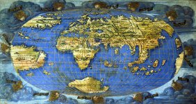
In his History of the Northwest Coast, v1: 1543-1800 (1884), on page 41 I found the following map. Apparently Oronteus Finaeus in 1531 adhered to the original idea that the New Regions (North America) were a part of Asia.

Basically, it appears that on the below map, the continent of the South America is hooked up directly to Asia. Sure does not make any sense.
  • Tarta Florida also sounds rather interesting, doesn't it?
Orontius_Finess_map_1531.jpg

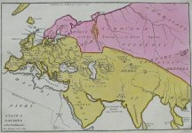
For whatever reason, a different blog article came to mind - America in Asia: 1827 State of Nations map. Personally, I do find coincidences highly suspicious in general. At some point, they stop being just coincidences, and become something more than just that. But I was not at that point yet.

Orontius_Finess_map_1531_1.jpg

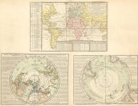
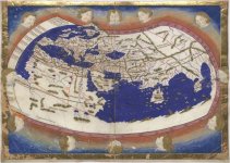
Not thinking much thus far, I kept on pushing the topic. Below is the map found on David Rumsey website.

1740 Carte des Lieux ou les
Differentes Longueurs du Pendule

Navigation Map
Carte des Lieux ou les Differentes Longueurs du Pendule.jpg
Not much done here, I simply moved North American continent from the left side of the map to the right side. I just figured, why not?

asian_america_1_1_3.jpg


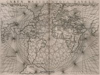
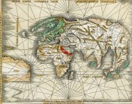
1561 Carta Marina Nvova Tavola
Carta_marina_nova_tavola.jpg
I did the exact same thing, and ended up with the map below.

Carta_marina_nova_tavola_2.jpg


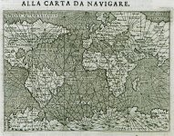
1620 - Alla carta da navigare
Porcacchi Tomaso
Alla_carta_da_navigare_-_Porcacchi_Tomaso_-_1620.jpg
Same operation followed

Alla_carta_da_navigare_-_Porcacchi_Tomaso_-_1620_3.jpg


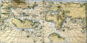
Planisfério de Rosselli - c. 1508
planisferio-roselli.jpg
This map has Hispaniola and Cuba islands on it. From this perspective it is much more interesting to connect both sides. The original map is slightly uneven on the left side, hence the break in connection.

planisferio-roselli_2.jpg


Fun Part
As you can see, the above map has islands like Cuba and Hispaniola on it. From this perspective, the resemblance between the map above, and a few of the older maps below is somewhat weird. What's also weird, we have a Spanish colony Veragua which was located in the Central America situated on one of these older maps.

Mapa_del_Ducado_de_Veragua.png

And it's not where it is supposed to be at. For whatever reason it is placed in that weird non-existent peninsula looking chunk of land.

beragua_1_1.jpg

mundo-roselli.jpg

At the very least, we have a few very interesting maps out there. What they may suggest is up to the individual observer.


map of the world_1.jpg

KD: Not much here, just a few of my observations. Still trying to figure out how Tartarian Kings end up in the North America, and why Russia used to own Alaska, a chunk of a far away land. Remember that:
  • Fort Elizabeth is the last remaining Russian fort on the Hawaiian islands
  • Fort Ross is a former Russian establishment on the west coast of North America in what is now Sonoma County, California.
  • There are more than 20 towns in the U.S. bearing the name of Russia’s capital Moscow, three St. Petersburgs and about 10 spots featuring the monikers of Russian regional towns.
  • All other things, people and places hidden from us...
 
Have you checked out godgevlamste's channel on youtube? I'm not sure how open you are to the idea of crater earth (you'll have to check out the channel I couldn't possibly do his entire channel justice via just one post) but I find a lot of his theories really interesting. He ties together the Brazilian concave earth theory quite nicely as well, their model almost exactly matches his - essentially his theory revolves around the idea of the hereford mappa mundi being a flat earth map from before the flood. He believes most history pre 1200 took place on this map and not on our current map (they may also have added say 800-1200 years onto our timeline and faked the dark ages), confusing things to a much greater degree. Interestingly Byzantium and Constantinople are two different cities on the hereford map. After the flood the right half freezes over leaving the left side of the crater or plane remaining (plus a lot more water) - the side which belonged to the Scythians (Tartaria Olim Scythia). After the flood, refugees from the flooded half of the plane/crater/world wash up on our current land masses and start causing mayhem (possibly the NWO), as I tend to believe the previous inhabitants were peaceful and hence why they were so thoroughly defeated.

The hereford mappa mundi looking like this:

1618544528715.jpg

via Wikipedia​

You'll have to check out his images and reasoning and formulate your own opinion, but his model features a semi classic flat earth map with the Americas flipped horizontally. The pillars of Hercules would be located below the tip of south America and would basically be the entry/exit way to our plane (crater in his view). I always liked this particular location of the pillars of Hercules as it would make a ton more sense how Plato's Atlanteans could come from beyond the pillars of Hercules, as if that were something unknown and not just beyond the straight of Gibraltar, which I clearly think they had knowledge of at that time.

Essentially what your left with is something like these:

1618544366268.jpg


1618544349499.jpg

Both images from Godgevlamste's youtube
I should probably clarify - he thinks our plane is a crater on the moon, a rather small one. And that the moon is actually a reflection of our greater plane reflected by the sun. One thing I like about this theory (well there's ton of things I like about it, but this one particularly) is that it would explain where all the floodwater came from - in his model our crater is located directly next to the Mare Serenitum, an incredibly large ocean multiple times larger than our measly crater (if that's what it truly is). In which case - the entry/exit to our plane - the pillars of hercules - would merely need to be tampered with and bam! - massive influx of water coming from outside the realm, not above.

I'm not sure if this helps explain at all how the Russians ended up in Alaska - but I think this theory does explain how the Tartarians wound up in North America - in my version of this theory the Tartarians were the original people on all the landmass we currently know.

Just a fun note on the the area south of the southern tip of South America - this is apparently one of our most mapped regions of the entire oceans floor - which I find suspicious given that it's one of the single most treacherous pieces of sea to traverse that we know of - hence not used for shipping. Unless it led to somewhere of interest?

1618543308004.jpg

Map via NIPPON FOUNDATION-GEBCO SEABED 2030 PROJECT (One-fifth of Earth's ocean floor is now mapped)
I was doing a little thinking about the hereford mappa mundi - if that truly were a preflood map, and our current map is half of that map but flooded, that would obviously imply water levels rose like crazy since most of that old map is land, with a small percentage ocean and then the red sea. So then I wondered - if our current world were a flooded hereford map - where would the hereford ocean be? My first thought would be great trenches as perhaps our current ocean floors might have been land? - and I may be reading too deeply into this, but I thought the shapes of the trenches just north of New Zealand matched up somewhat nicely with the one ocean on the Hereford map (that weird Florida shape with the arm jutting our from the right angle with a couple of horns at the end). If our maps are totally wrong anyway - those trenches might be closer to North and South America than we think - as it might look if we flooded a hereford map as seen in the above crater earth maps.

Speaking of the Brazilian concave earth theory and crater earth - both of these theories make me think heavily of George R. R. Martin's works the Song of Ice and Fire (Game of Thrones). In it - the last Targaryan (Tartarian? She has silver hair I think perhaps our version would have been red) lives in a world taken over by rulers from another land who cut the empire into warring and conniving nations. She must then traverse beyond the ice wall to where the free folks live (in the brazilian concave earth theory this could possibly be the little ice encircled land mass above ours). She also gives birth to dragons and magic is restored to the world - I'm not sure exactly on this one but I think this has to do with whatever made the antiquitech stop working - possibly having to do with pole shifts in our case. Bottom line I think GRRM is on to something.

Quick return to the Scythians - youtube channeler Asha Logos has a series called "Our Subverted History (Conspiracy?)" or something to that extant - which provides a more classical alternative history of the Scythians/Thracians/Phrygians/Vikings/Goths/OstroGoths/etc. etc, all being one family - the family which came before the new arrivals, who essentially welcomes the new arrivals so long as they stayed in line (or not as seen in the 4 sackings of Rome) but were ultimately defeated. He sources a book called the Oera Linda Book (interesting piece of literature that you should certainly look into if you haven't already) along with a lot of other first hand accounts from previous time periods which paint a much different version of history than what's in our textbooks, even from a classical perspective. I think these Scyths/Goths/Phrygians were the Tartarians (Possibly giants, or at least co-existed with Giants) who lived on every inch of the land that we know today until they were most likely destroyed by weapons that they thought were immoral. If you follow Admiral Bird's account - the great people from inside the Earth told us they were worried about our use of atomic weapons, and possibly whatever weapons we were using before that to vaporize entire cities.

Sorry for the long kind of all over post, I hope you were able to follow. I just want to say I absolutely love your blog. Just about everything I've thought of you've already covered with a blog post - seriously applaudable work my friend. One thing I've been looking into recently, and this is relatively small because you've covered just about everything you absolute beast - funiculars (particularly the ones in Switzerland and thereabouts). Just another anachronistic tidbit - I'd love to see what you would dig up on them.
 
Been lurking this site for weeks now. Came across a pic so good I had to share, hope I'm doing this right. It seems the Soviet police identified people as "Tartar". I'll include the link to the article,
Interesting thing to point out - here in the Czech Republic (and Slovakia too) we still have a saying that freely translated basically means "as a Tartar / Tatar" - to describe that a person did something completely wrong and misunderstood the whole situation.

You use that phrase as for example "You're handwriting like a Tatar!" or "You completely f**ed that up. Like / as a Tatar". "You're counting like a Tatar." - as in you're sh*t at Maths. Heard that a lot.

My elementary school teacher used that term frequently, she could be around 60-70 years old now. Curious how the term survived, and why Tatars were frowned upon (well, they weren't the victors / history writers, so it could just be intentional "defamation". But I always assumed the language was similar to Slavic - who knows anyway)
 
Back
Top