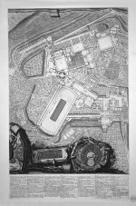
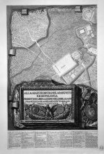
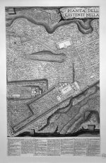
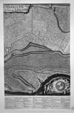
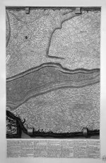
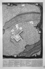
1781: Aerial view map of Villa Adriana by Francesco and Giovanni Battista Piranesi

villa-piranesi.jpg

Giovanni Battista Piranesi's Plan of Hadrian's Villa

Below you will find two images. One of them is the etching done by Battista or Francesco Piranesi some time in the 18th century. The other one is a screenshot of the same area I did 5 minutes ago using Google Earth. From what I see the two are close to being 100% identical, bar the time difference.

Piranesi_Villa_Adriana-td.jpg

I think that Mr. & Mr. Piranesi had an access to some older sources, and/or tchnology. Here is the full geo line up of the area allegedly done by Piranesis.

And to top it off, how about that? It looks like the above map was originally made on marble. Below is an example (for demonstration purposes) of a different Piranesi family map. It is broken down in fragments and is titled:
  • Map of Rome drawn with the situation of all the ancient monuments, of which today the remains can still be seen, and illustrated the fragmented hills of marble of the map of ancient Rome, excavated, will be two centuries old, in the ruins of the Temple of Romulus; and now existing in the Campidoglio Museum.
  • Source
1280px-Piranesi-1003.jpg


KD: Any ideas on how Piranesis did these areal maps around 1780s? Were armies of surveyors employed, or they simply copied the maps depicted on the older marble slabs?
 
When he was hired by the pope of his time (i forgot the name) to map the city of Rome, he also received a significant budget for this project. He was a professional architect, mathematician, artist and engineer. He hired a small army of surveyors and they did honest-to-god boots on the ground measurements and calculated all of it to obtain this level of accuracy. He also used the best astronomical tools of the time to measure the cardinal points correctly and find the right references to the buildings and geographical features. So one might say he was also pretty good at astronomy. He was definitely a genius of his time and it saddens me to see all these modern quakademics ridicule his work and call it fictional. Yes he did make one or two books with imaginary drawings, but he did mention so. You cannot put all of his honest architectural work in the same basket with his imaginary work and call it "SAME". That is disrespectful to a man who was way ahead of his time. I see the same thing about ancient cartographers that have drawn detailed maps of Hyperborea and Antarctica. The quackademics cannot possibly imagine a version of reality that does not fit their established views...
What strikes me stupid is not only how well he made the topographical map just with good old fashioned tools and math, but also how well he represented the height map showing us in great detail the parts of Rome that were not yet excavated at that time. Even if you know nothing about map making, you can tell those features on the east side are some kinds of mounds. My goodness, the amount of work it must have taken to excavate an entire ruined city from a blanket of over 10m of dirt is staggering. They must have been at it for 100 years. Imagine the look on the archeologit's face when his worker finally dug all the way to street level and discovered the first roman cobblestone road. His jaw must have dropped as they were still using horse carts with wooden wheels and dirt roads...
The fragments he drew on the sides were part of a large city plan that used to be the floor of one of the ruins. They only found a few intact fragments and many small illegible ones. He tried for a year to put the puzzle back together as he was fascinated by the glory of ancient Rome, just like we are, but alas he had to move on to other projects. There were too few pieces to work with. His passion for his work and his wonder about the old world comes through brilliantly in his fine work.
 
I have a pet theory (and very little evidence) that starforts had aerial capabilities.
1699754522593.jpg

(edit, aside: Which, in my opinion, might explain this event a bit: 1561 celestial phenomenon over Nuremberg - Wikipedia
I suspect it was an aerial battle between starforts/star-cities. Again, pet theory with very little evidence, but I've felt strongly about this for about a year now.)

additional edit: WOW and somehow I'm just now noticing the description on that Starforts.com site I linked: "The starfort first appeared in Italy at the end of the 15th century." Lines up pretty well with the "1561 celestial phenomenon over Nuremberg" event I'd say..
Sorry if this is not the place for it. I should probably make an entire post or something. I do think this may hold a key to understanding the highly detailed accuracy of aerial pictures and "bird's eye view" sketches before the existince of most aerial technology we're taught about though.
 
Last edited:
Similar articles
Article starter Title Section Replies Date
KorbenDallas 4th century AD Antient Sports by Girls in Bikini, Villa del Casale Bizarre 0

Similar articles

Back
Top